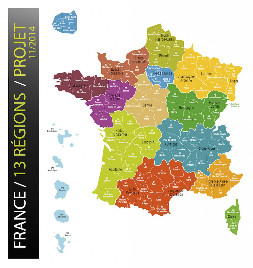
A new map of France reorganised its internal administration, reducing the number of regions from 22 down to 13. from January 2016 with the aim of simplifying bureaucracy and reducing costs.
Beforehand, the country was divided into 22 administrative regions, which in turn are divided into departments.
France is decentralised to coordinate and deliver state functions more effectively. While French regions cannot introduce new laws they do have considerable discretionary power over infrastructure and operational spending in education, tourism, public transit, universities and research, unemployment, and assistance to businesses.
Of the new 13 regions in the new map of France, only seven result from a change. Current departments remain unchanged for the moment however this may change in coming years.
The regions that changed are:
- Grand-Est (Alsace, Champagne-Ardenne and Lorraine)
- Nouvelle-Aquitaine (Aquitaine, Limousin and Poitou-Charentes)
- Auvergne-Rhône-Alpes
- Bourgogne-Franche-Comté
- Occitanie (Languedoc-Roussillon and Midi-Pyrénées)
- Hauts-de-France (combining Nord-Pas-de-Calais and Picardie)
- Normandie (combining Basse-Normandie and Haute-Normandie)
The other 6 regions stay just as they were before:
- Bretagne
- Corse
- Centre
- Île-de-France
- Pays de la Loire
- Provence-Alpes-Côte d’Azur
© PHOTO MINISTÈRE DE L’INTÉRIEUR